Planimeter Pro for map measure
9.0
Planimeter Pro for map measure
9.0
Planimeter is a tool to measure distance and area on map.
It can measure anything visible on the satellite map, like lawns, fences, farm, road, roofs and so on.
~~~~~~~~~~~~~~~~~~~~~~~~~~~~~~~~~~~~
● Thanks to more than 3250,000 people who have chosen "Planimeter Pro"
● "GREAT - Wonderful app. Very useful and easy to use. Most of the time I use it to measure distance sailed on San Diego bay." by Perfent
● "Great app for an accurate measurement - This app saves a lot of driving around! Good in the hi res areas" by DaveHebner
~~~~~~~~~~~~~~~~~~~~~~~~~~~~~~~~~~~~
Features:
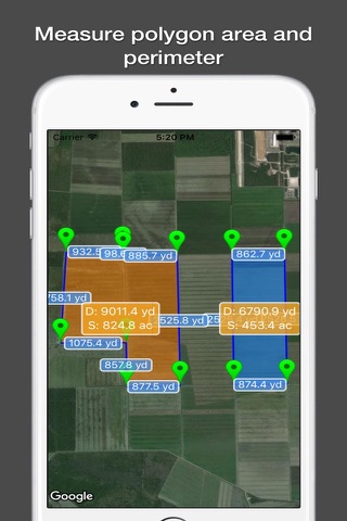
● Support measure distance and area.
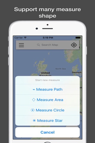
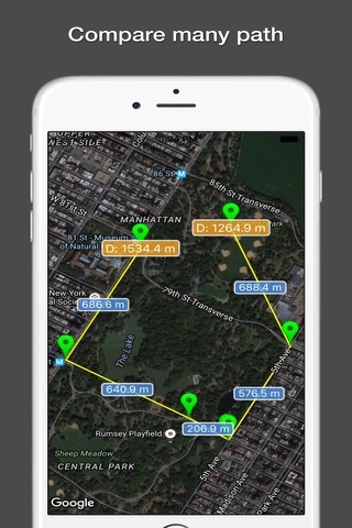
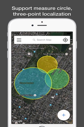
● Support measure as path, polygon, star or circle.
● Support measure multiple area at same time.
● Visual records list, save and share.
● Support Apple map and Google map.
● Use cross hair to location, easy and accurate.
● Locate by search or GPS.
● Support length unit like foot, nautical mile, mile,inch, yard, meter,kilometer.
● Support area unit like square meter, are, declare, hectare, square kilometer,acre and so on.
● Support custom unit, add any unit your needed.
● Fill color, board color and text is configurable.
● Support live record by GPS.
"Continued use of GPS running in the background can dramatically decrease battery life."
It can measure anything visible on the satellite map, like lawns, fences, farm, road, roofs and so on.
~~~~~~~~~~~~~~~~~~~~~~~~~~~~~~~~~~~~
● Thanks to more than 3250,000 people who have chosen "Planimeter Pro"
● "GREAT - Wonderful app. Very useful and easy to use. Most of the time I use it to measure distance sailed on San Diego bay." by Perfent
● "Great app for an accurate measurement - This app saves a lot of driving around! Good in the hi res areas" by DaveHebner
~~~~~~~~~~~~~~~~~~~~~~~~~~~~~~~~~~~~
Features:
● Support measure distance and area.
● Support measure as path, polygon, star or circle.
● Support measure multiple area at same time.
● Visual records list, save and share.
● Support Apple map and Google map.
● Use cross hair to location, easy and accurate.
● Locate by search or GPS.
● Support length unit like foot, nautical mile, mile,inch, yard, meter,kilometer.
● Support area unit like square meter, are, declare, hectare, square kilometer,acre and so on.
● Support custom unit, add any unit your needed.
● Fill color, board color and text is configurable.
● Support live record by GPS.
"Continued use of GPS running in the background can dramatically decrease battery life."
Celkové hodnocení
Sdílet
Souhrnné informace o Planimeter Pro for map measure
-
Verze programu
9.0 -
Autor
-
Potřeba instalace
ano -
Velikost souboru
36,92 MB -
Systémové požadavky
Aplikace pro: iPhone, iPad -
Jazyk
- Angličtina ,
- Čínština ,
- Francouzština ,
- Italština ,
- Japonština ,
- Němčina ,
- Portugalština ,
- Ruština ,
- Španělština
-
Staženo
1× celkem
0× tento měsíc -
Poslední aktualizace
12. 5. 2020